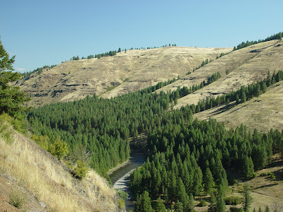


Eastern Oregon has lots of hills, canyons and plateaus and a few rivers. The climate is quite dry and unless the land is irrigated it grows very little more than sage brush and prairie grasses. Where it is irrigated though there are lush alfalfa fields, wheat fields and a crop that appears to be potatoes or turnips, can't say for sure what. We have concluded that the haze that seems to be obvious in any of our photos of far away objects, is partially due to the wheat stubble being burned. Once the wheat is harvested and the straw is baled, it is common to burn the stubble before planting the next crop. I presume this is to kill weeds and insects.
We passed a large wind generation facility this morning that had about 60 or 70 windmills. These are still somewhat of a novelty to see.
Near Prairie City there was a roadside information station in the form of a large conestoga wagon with bulletin boards and posters about local events and historical data. We thought it was worth a couple of photos.
I should have mentioned earlier, if you want to see any photo in full screen mode, just double click on the photo. To return to the blog and continue, just use the 'back arrow' on the upper left corner of your browser.
Another note about navigation in the blog, to see some of the earlier photos we posted, when you get to the bottom of the current postings, there is a blue colored link that says older posts. Clicking on that link will take you to the earlier photos.